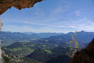
 View from Untersberg, in the middle of October. Photo: Sofia Valentin | It's a week into November. School started officially on 1st of October, but the first couple of weeks didn't feel important. It’s not until now that I feel that university has started and that I can actually tell you a bit about some of my courses... |
(It turns out all bachelor level geography is in German, so I am taking Master level courses at the GeoInformatics faculty, which is actually what I wanted since I have all my points for my Bachelors)
Let’s start with this pretty cool thing the Salzburg University provides. Allow me to nerd out for a bit.
If you're a geographer you probably know about ESRI, if you don’t; they make Geospatial software and have won awards for their many educational programs. Their vision connects exactly to why I believe my education is the right one;
“We believe that geography is at the heart of a more resilient and sustainable future.”
No doubt. One of their programs, Virtual Campus, provides a long list of web courses. Organizations or private people can buy a license to use this virtual campus for an annual fee of $ 2,500. Which University of Salzburg does for us Master students! I am very happy for this as their courses are very simple to use, extremely well organized and super interesting. The university bunches a couple of the web courses together into one official course and gives you 1 ECTS credit when you finish it. Right now I am working on Natural Resource Applications.
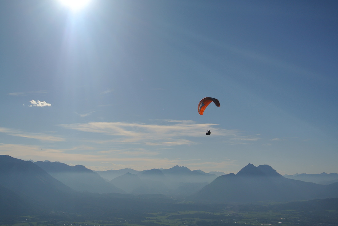
Wishing that was me, view from Gaisberg one sunny October afternoon. Photo: Sofia Valentin
University courses...
Geovisualization and Advanced Cartography 6 ECTS
We have just turned in a group made map with data from Open Street Map, OSM . OSM is a collaborative, editable and free map online, their slogan is “The free wiki world map”. The object of this project was to create an audience specific, well designed map based on the Almkanal somehow. Using the OSM data, we created a map in ArcMap with 10 historic places along the channel for walk happy tourists, you can check it out below.
| The Almkanal is a water channeling system that leads into the city from the south and was built in and around the 12th century to provide water for the grain mills, fountains, in case of fires as well as drinking water. | 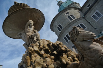 Residentzbrunnen built in the 17th century, it's water was lead from the almkanal. Photo: S. Valentin |
The next project in this class is making a version of the map on Leaflet. Leaflet is an application programming interface, API, so there will some programming. I started using the codeacademy.com to learn JavaScript programing language.
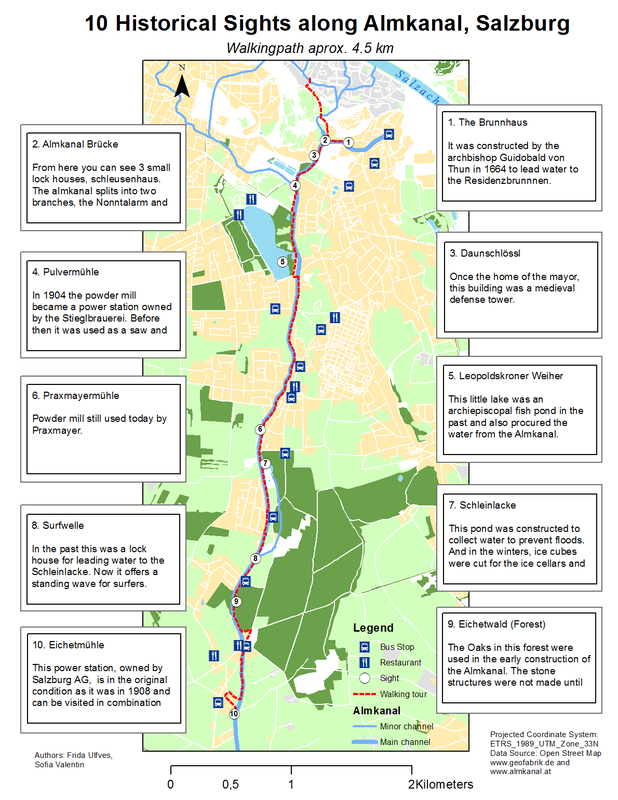
Project by Sofia Valentin and Frida Ulfves, Geovisualization and Advanced Cartography, Salzburg University, Professor Hofer.
The class and professor had very positive feedback during the critique session. They liked the layout, and the fact that the inset sight texts are laid over the map made it feel more "dynamic instead of static". Pretty much the only thing they felt was missing were more labels of the areas and street names, which I completely agree with.
Do you see number 8 on the map?
I haven't been there, but its a really cool thing, check it out:
Do you see number 8 on the map?
I haven't been there, but its a really cool thing, check it out:
Advanced Remote Sensing 6 ECTS
Obviously this course has a prerequisite, I've taken Remote Sensing for Landscape Studies at LU. The focus on this course will be on some data acquisition techniques, image pre-processing and image analysis based on the OBIA approach.
Obviously this course has a prerequisite, I've taken Remote Sensing for Landscape Studies at LU. The focus on this course will be on some data acquisition techniques, image pre-processing and image analysis based on the OBIA approach.
So far we have explored LiDAR, Radar and Object Based Image Analysis (OBIA), a workflow invented at Salzburg University as the teacher clearly is very proud of, but tries to not let it show too much. I think I will come back to that technique another time when I feel that I can explain it better.
We are using a Trimble software called eCognition ( <-- download a free trial there) , which seems very powerful, but a bit difficult to work with when you're used to ArcMap.
Outside of school, I am also taking an Esri MOOC, a Massive Open Online Course called Going Places with Spatial Analysis. It’s not too late to sign up , and it’s a great free opportunity! Listen to their pitch:
Also, here is a link to and Esri page that inspires me. Have a look if you're also interested in conservation and natural resources...
http://www.esri.com/industries/conservation
Alrighty, done with the nerdiness for now. Next blog will be about traveling...
http://www.esri.com/industries/conservation
Alrighty, done with the nerdiness for now. Next blog will be about traveling...
 RSS Feed